
New Home Community Map Artist Renderings and Illustrations
Marketing Graphics for Web and Print
You supply a copy of your plat map; our graphic designers and programmers convert your black and white, static, plat map to a fully interactive digital mapping system with roll-over effects and clickable reference areas for linking to resources for the lot selected.
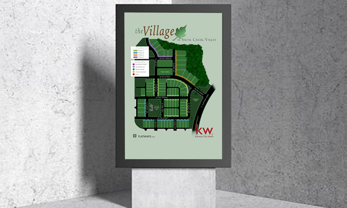
Colorized Site Plans for Your Community
Bring Your Community to Life with ePlatMaps' Colorized Site Plans
Transform your engineered site plans into vibrant, colorized site plans that enhance communication and marketing for your community. At ePlatMaps, we take aerial-view drawings of your property—created by engineering firms to show features relative to lot boundaries—and turn them into dynamic, visually appealing maps. These interactive tools help developers, HOAs, planners, and builders communicate clearly during every phase of development, from construction permitting to zoning and community engagement.
Why Choose Colorized Site Plans?
Our colorized site plans combine technical accuracy with stunning visuals, offering:
- Enhanced Visual Communication: Transform complex engineered plans into clear, colorful maps that are easy to understand for stakeholders, buyers, and residents. Real-Time Information: Display up-to-date details on lots, amenities, and development phases, accessible on desktops, laptops, tablets, and mobile devices.
-
Interactive Roll-Over Details: Provide instant access to key information, such as:
- Lot number, size, and status (available, under contract, sold)
- Zoning and permitting details
- Builder or HOA contact information
- Links to virtual tours, community websites, or marketing materials
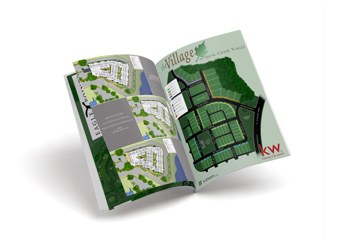
- Custom Visuals: Our artist renderings and illustrations add a professional, branded aesthetic, tailored to your marketing needs for web, print (postcards, brochures, folders), or large-format displays.
- Built-In Lead Capture: Use integrated contact forms to generate inquiries from potential buyers or stakeholders, streamlining communication.
Benefits for Your Community
- Streamlined Development Phases: Support construction permitting, planning, and zoning with clear, interactive maps that align with engineered plans.
- Effective Marketing: Create visually compelling maps for HOAs, home builders, or community websites to attract buyers and engage residents.
- Cost Efficiency: Reduce reliance on printed materials by delivering digital, real-time solutions that are easily updated via our intuitive dashboard.
- Versatile Applications: Use colorized site plans for community websites, sales presentations, HOA intranets, or large-format prints at events like Parade of Homes.
Tailored for Your Needs
We collaborate with you to ensure your colorized site plans meet your specific goals, whether for web-based interactive maps, printed brochures, or large-scale displays. Our team enhances engineered plans with custom artist renderings and illustrations, blending technical precision with aesthetic appeal to make your community stand out.
See It Live: Book a Demo
Discover how ePlatMaps' colorized site plans can elevate your community's development and marketing efforts. Contact us to schedule a live demo and learn how to manage your interactive maps from any device, ensuring critical information is always at your fingertips.
Get started today-bring your community to life with ePlatMaps!
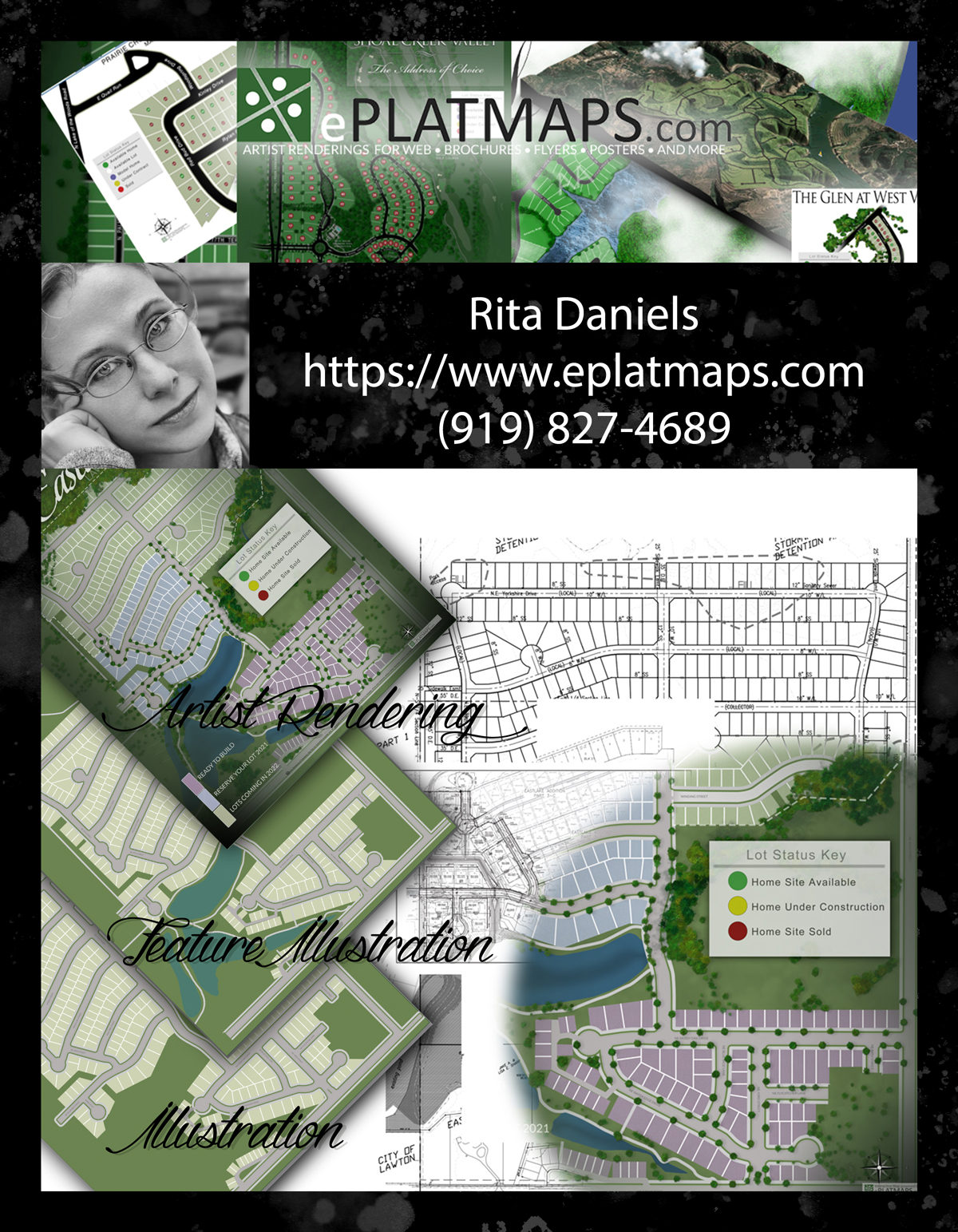
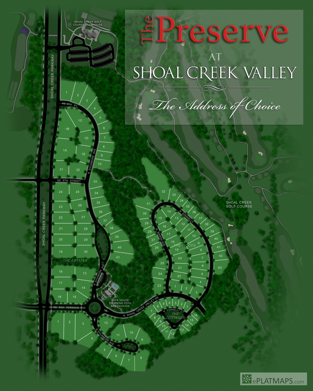
Site Plan Artist Renderings
Our Site Plan Artist Renderings are our most popular of our three plans. We combine the two Illustrations into one and then go the extra mile by hand painting trees, water features, dams, creeks, and even adding custom shadows to really make your artwork pop and come alive. It does take more time.... but it is totally worth it.
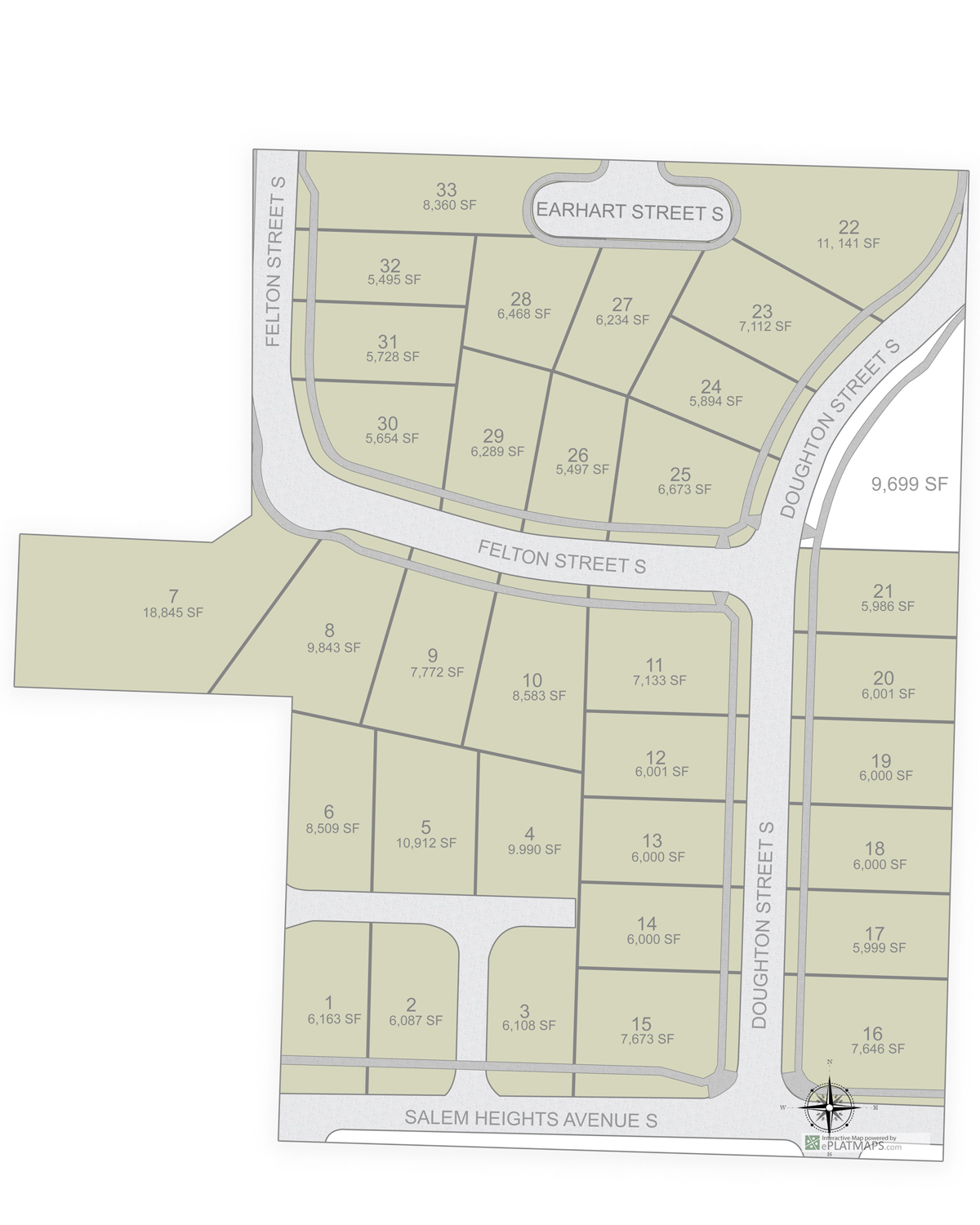
Basic Site Plan Illustration
A colorized representation designed to communicate a basic idea, story, or concept, often simplified. Illustrations are versatile and are used in marketing, education, or storytelling.
Characteristics:
- Often used for print and digital purposes.
Our Basic Illustration will give you basics of your property. We create a graphic that your marketing teams can easily implement into any of their marketing pieces and on your website. Illustrations are usually 3 to 4 colors.
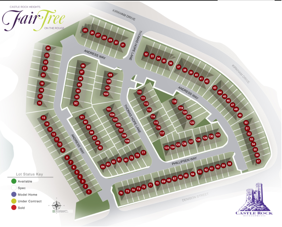
Detailed Site Plan Illustration
A visual interpretation or artistic representation designed to communicate a specific idea, story, or concept, often stylized or simplified. Illustrations are versatile and can range from realistic to cartoonish, used in marketing, education, or storytelling.
Characteristics:
- More artistic and interpretive, with varying levels of realism.
- Focuses on aesthetics, creativity, or narrative over technical accuracy.
- Often used for branding, brochures, or decorative purposes.
Our Detailed Illustration will give you the ability to include amenities, key features like water ways, trails, side walks, parks, playgrounds, club house, pools and more that will be in your property.
Artist Rendering
A detailed, often realistic visual representation of a concept, design, or planned project, typically used to visualize something that doesn't yet exist (e.g., architectural plans, landscapes, or future developments). Renderings prioritize accuracy and functionality, often used in technical or professional contexts like real estate or urban planning.
Characteristics:
- Highly detailed and realistic, often photorealistic.
- Focuses on technical accuracy (e.g., scale, proportions, spatial relationships).
- Often used for presentations to stakeholders (e.g., developers, clients).
Our Detailed Illustration will give you the ability to include amenities, key features like water ways, trails, side walks, parks, playgrounds, club house, pools and more that will be in your property.
Print Ready Colorized Map Sizes
| Standard Poster | Size |
|---|---|
| A4 Paper | 8.5x11 inches |
| Small | 11x17 inches |
| Medium | 18x24 inches |
| Large | 24x36 inches |
| Custom | Billboard |
We can do large format for billboards and signs.
View our Portfolio